Friday 13 May 2011

Insects at Ashover

I have wanted to see one of these for ages. Black & red froghopper (Cercopis vulnerata) sunning itself on Blackberry leaves.
Green-veined white (Pieris napi)
Speckled Wood (Pararge aegeria)Dance fly (Empis tessellata)
Nettle Weevil (Phyllobius pomaceus)
The nymph of a Green Plant Bug (Calocoris alpestris)

Thursday 28 April 2011

The view from Shuttlingsloe

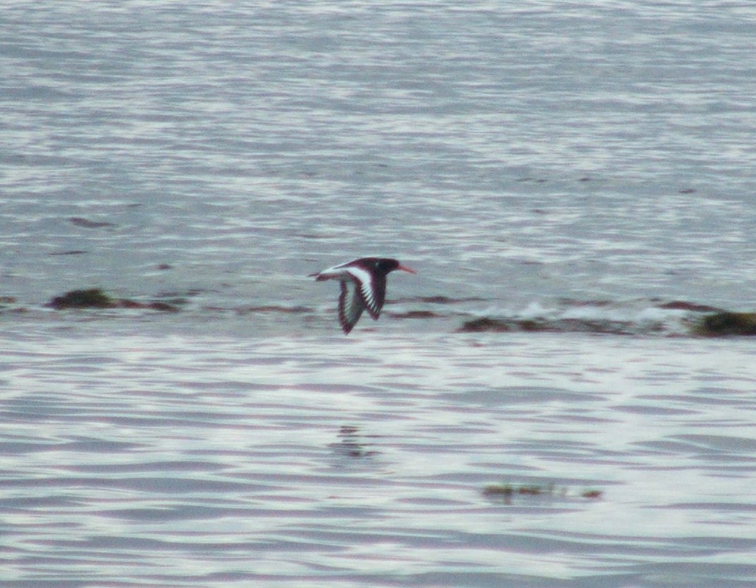
First the Hill itself! I took advantage of one of the nice days over Easter to walk up Shuttlingsloe in cheshire. The peak is really one of the western most peaks in the Peak District National Park. I had first seen Shuttlingsloe from the Roaches back in 2003 and vowed to walk up it one day. A good day here will give you a view to Snowdon. However this day was a hazy one and views were restricted to about 10 miles.


Of course back in 2003 we walked from the bus stop on the road near Axe Edge Moor, over Oliver Hill, through Flash and then down to the Youth Hostel near the Roaches themselves. This photo shows Oliver Hill (about 3 miles away) from the summit. The hill in the near ground is Cut Thorn Hill.


The vast Whetstone ridge fills the eastern horizon.


Further to the north Shining Tor.


Looking South over the flanks of the Roaches you can just see Tittesworth Reservoir that dominates the view from the Roaches itself.


And now for the Roaches. It was a similarly hot day when I was there looking this way.


Another feature that you can't help but notice from The Roaches and from Shuttlingsloe is the Silk 106.9 FM radio tower on Sutton Common to the East.


Sutton Common from a distance. The small hill to the left is the Cloud.
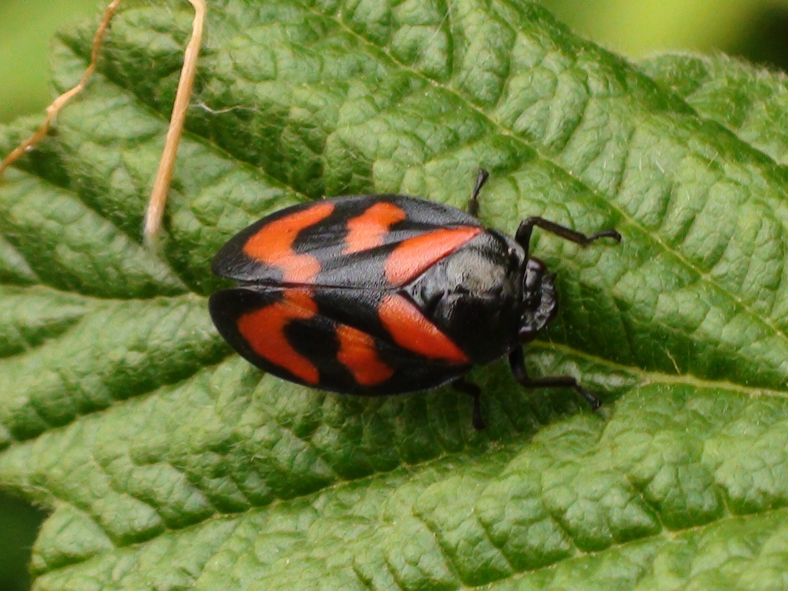
Sunday 13 February 2011

Signs of spring down at Watermead

It is that time of year again. Down at Watermead the snowdrops are out in force.
A nice surprise was seeing two pair of Little Grebes (Tachybaptus ruficollis) on the river near Watermeade Bridge.
The Crack Willows (Salix fragilis) were just showing the first signs of spring returning as well.
Then on the shed at the bottom of the garden I found this chap.
Green shield bug (Palomena prasina) in its winter brown colouration.

Friday 11 February 2011

Kayaking Ullswater

Back to the lake district then for a retelling of our Kayaking Ullswater expedition. It was back in the atrociously wet summer of 2008 and the day threatened to be similar to all the other rainy days we had experienced whilst we were there but to our great relief the clouds held their precipitation until after our jaunt up the water. The photo above shows where we launched our boat from at Pooley Bridge. The tree covered hill is Dunmallard Hill. This pokey little hill at the end of the glacial valley could be a roche moutonee or drumlin. I'm not sure which, maybe a geographer could tell me.
Looking up the lake now. On the left the steep bank leads up to Arthur's Pike of Barton Fell before Swarthbeck Gill dips the profile slightly and Bonscale Pike rises again behind. Then the profile drops significantly down to where the boats are on this picture. Behind the third mast that breaks the horizon is the low profile of Steel Knotts and to the right of that Beda Head. Behind the nearest boat Hallin Fell. Then disappearing into the rain behind that is High Dodd and Place Fell.
Another look at Arthur's Pike of Barton Fell and Bonscale Pike.

Hallin Fell with High Dodd and Place Fell behind. The hills stretching away just to the left of the boats sail actually trace the course of the lake. The lake doglegs to the right here before returning back to the left. Those distant hills mark the western valley side further up. Visible to the left of this image is Birkhouse Moor. On a clear day Helvellyn can be seen above these foothills. To the right of the sail you can see the dark summit of Sheffield Pike and to the right of that Raise.

Walking around Derwent Water

Back in 2008 I walked around Derwent Water in the Lake District on a cloudy day. It was a long walk but a really good one. The view above shows the familiar shape of Blencathra looking down on the dark waters. We walked anticlockwise around from Keswick, passing the Catbells (above).
The peaks from left are Ether Knott on Grange Fell and Kings How on Grange Fell. Then looming in the background the slopes of Glaramara. A small hump to the right of that just before the steep foreground of High Steel Knott on High Spy is the much more distant Esk Pike.
Blencathra.
Framed between the steep slopes of Kings How on Grange Fell and High Steel Knott on High Spy the little foreground knoll of Castle Crag. On the left of this is the distant Glaramara and on the right Great End.
As we rounded the southern end of the water Skiddaw came into view above Keswick.
Skiddaw.
A friendly Belted Galloway cow in a stream.
Then as we walked back up the eastern coast of the water the sun came out. Maiden moor on the left, Cat Bells on the right.
From the left, the edge of Catbells descending. The sharp spire of Causey Pike. Then the slope descends down to Outerside. Then the little knoll is the very top of Sand Hill and next to that the very top of Hopegill Head. The larger peak to the right is Grisedale Pike.
Causey Pike.
Looking all the way back to Great End.
Great End. It was a nice walk, with plenty of good views and things to see.


Saturday 22 January 2011

A trip to Scotland

Back in 2009 I spent a week in spring up in Scotland near the seaside town of Largs. Over the week several birds crossed my path. The Gannet (Morus bassanus) above made several dives whilst we watched.
A Curlew (Numenius arquata).
An Oystercatcher (Haematopus ostralegus).
On the mainland near Largs, a couple of Shelduck (Tadorna tadorna) strolled along.
On the ferry to Arran a Skylark (Alauda arvensis) hitched a ride.
A first for me, a Black Guillemot (Cepphus grylle) from the Arran ferry.
Another first for me, Red-breasted Mergansers (Mergus serrator) on the Island of Arran.
On the ferry back from Arran, a Herring Gull (Larus argentatus) followed the boat looking for food. The red spot on its beak confirms its identity.

Sunday 16 January 2011

A wander up Crinkle Crags

Back in 2004 I lead a Hiking Club expedition up Crinkle Crags in the Lake district. Here are some of the photos from that day. The picture above shows the Crinkle Crags in profile against the sky.
We walked out of Langdale Valley and up a path called the Band.
It was early April and recent rain had swollen the streams and made the waterfalls flow abundantly.
To the South front the Band we could see Pike of Blisco and beyond that to Wetherlam.
When we got to the top of the neck between Bowfell and Crinkle Crags we were rewarded by a great view west towards Scafell (on the left) and (Scafell Pike on the right). This is the only time I have ever seen Scafell cloudless despite climbing up most of the hills around here.
The view back east was one of Windermere and to the south (right on this picture) Morcambe Bay.
The Scafell range.
The path across the Crinkled summits of the mountain.
Sunlight catching the top of Pike of Blisco.
On our descent bands of sunlight would slide across the landscape, looking almost like it was being scanned by some alien spacecraft. The Langdale Pikes (above) caught the light wonderfully as the afternoon wore on.
A look back up towards Bowfell. The scar in the landscape being Hell Gill.
The Langdale Pikes.
All in all it was one of the really pleasant days, where the walk wasn't too strenuous and the weather offered good views. Its days like this one that make you want to return.