Friday, 1 August 2014

When the journey lay all ahead

This blog started as a non purposeful documentation of my wanderings around and musing at wildlife and nature. However after several years of not updating it my life has moved on and things of great importance now seem insignificant and things of no great significance now seem important.

I have always liked climbing and being in the outdoors. Now I have children I want them to also share in the joy of being out there on the rock and savoring life at its richest. So here is the challenge that I am setting myself. To take my children and climb three technically easy but exposed classic routes.
1) Pillar Rock
2) The Inaccessible Pinnacle
3) The Aaonach Eagach

I am confident that I could climb all three next week. However my children are all under five years old. Though I do not plan to take them climbing these routes just yet, I do want to steer their childhoods so that before I am too old we can climb these together. What this blog will now become is a documentation of the years of training and practice that will go into my kids so that when the time comes we are successful at reaching the summits of these three legendary British climbs.

When the journey lies all ahead you are at the best part of the whole adventure.
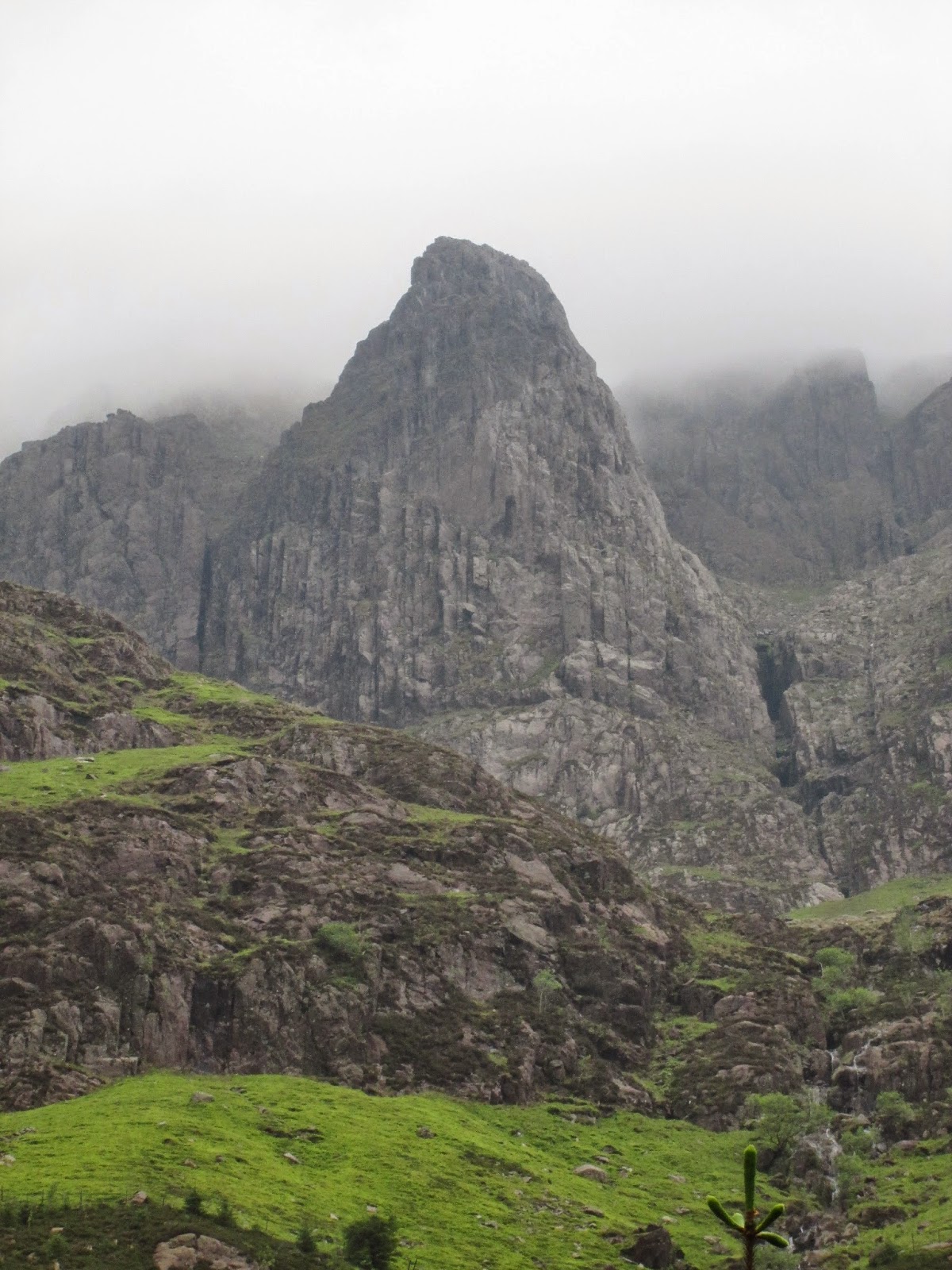
Pillar rock.

Saturday, 21 April 2012

Spiders in the Garden

 Two spiders in the garden. The first Philodromus Philodromidae.
The second a delightfully emerald Araniella Araneidae

Friday, 13 May 2011

Insects at Ashover

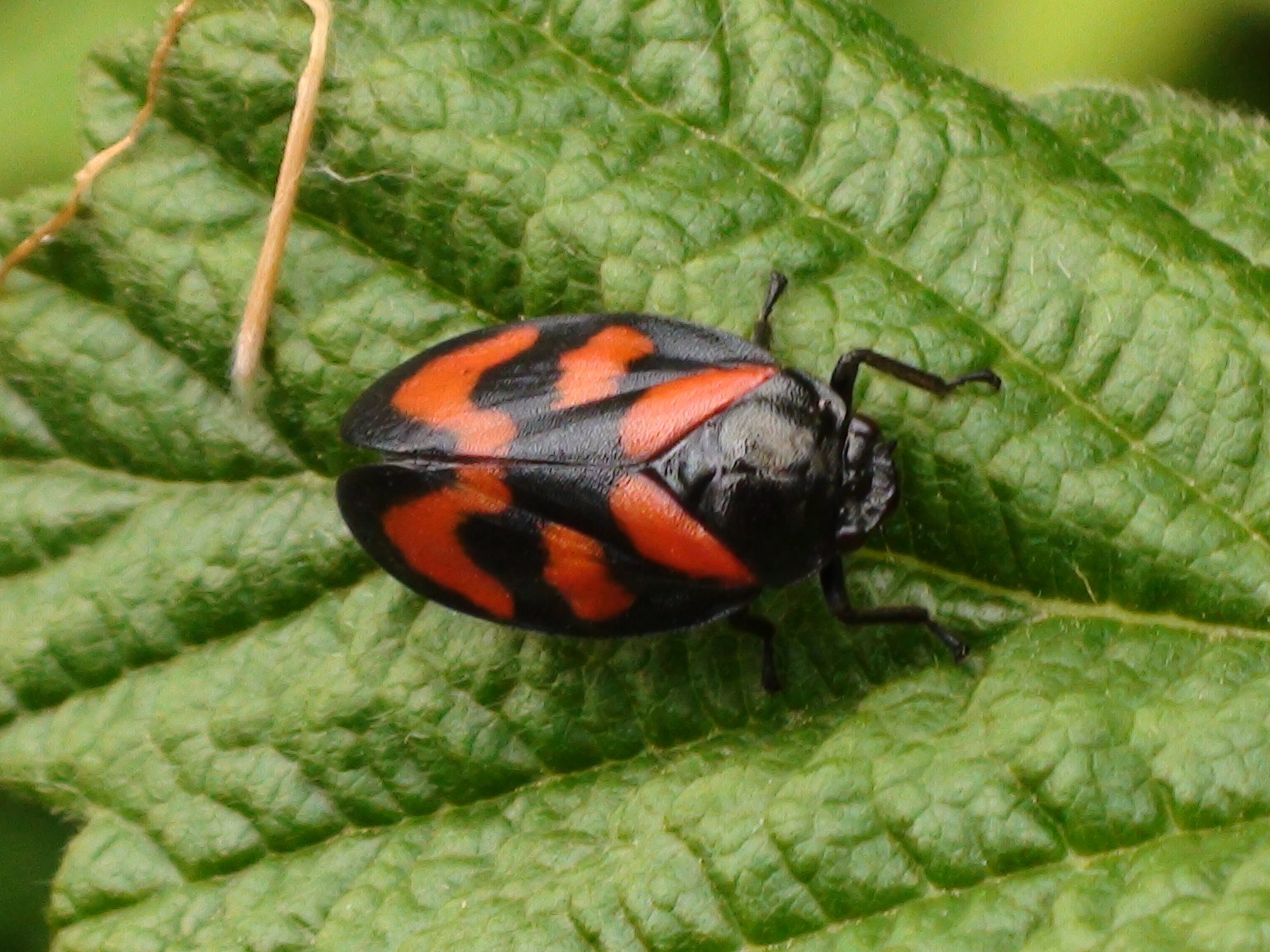
I have wanted to see one of these for ages. Black & red froghopper (Cercopis vulnerata) sunning itself on Blackberry leaves.
Green-veined white (Pieris napi)
Speckled Wood (Pararge aegeria)Dance fly (Empis tessellata)
Nettle Weevil (Phyllobius pomaceus)
The nymph of a Green Plant Bug (Calocoris alpestris)

Thursday, 28 April 2011

The view from Shuttlingsloe

First the Hill itself! I took advantage of one of the nice days over Easter to walk up Shuttlingsloe in cheshire. The peak is really one of the western most peaks in the Peak District National Park. I had first seen Shuttlingsloe from the Roaches back in 2003 and vowed to walk up it one day. A good day here will give you a view to Snowdon. However this day was a hazy one and views were restricted to about 10 miles.


Of course back in 2003 we walked from the bus stop on the road near Axe Edge Moor, over Oliver Hill, through Flash and then down to the Youth Hostel near the Roaches themselves. This photo shows Oliver Hill (about 3 miles away) from the summit. The hill in the near ground is Cut Thorn Hill.


The vast Whetstone ridge fills the eastern horizon.


Further to the north Shining Tor.


Looking South over the flanks of the Roaches you can just see Tittesworth Reservoir that dominates the view from the Roaches itself.


And now for the Roaches. It was a similarly hot day when I was there looking this way.


Another feature that you can't help but notice from The Roaches and from Shuttlingsloe is the Silk 106.9 FM radio tower on Sutton Common to the East.


Sutton Common from a distance. The small hill to the left is the Cloud.

Sunday, 13 February 2011

Signs of spring down at Watermead

It is that time of year again. Down at Watermead the snowdrops are out in force.
A nice surprise was seeing two pair of Little Grebes (Tachybaptus ruficollis) on the river near Watermeade Bridge.
The Crack Willows (Salix fragilis) were just showing the first signs of spring returning as well.
Then on the shed at the bottom of the garden I found this chap.
Green shield bug (Palomena prasina) in its winter brown colouration.

Friday, 11 February 2011

Kayaking Ullswater

Back to the lake district then for a retelling of our Kayaking Ullswater expedition. It was back in the atrociously wet summer of 2008 and the day threatened to be similar to all the other rainy days we had experienced whilst we were there but to our great relief the clouds held their precipitation until after our jaunt up the water. The photo above shows where we launched our boat from at Pooley Bridge. The tree covered hill is Dunmallard Hill. This pokey little hill at the end of the glacial valley could be a roche moutonee or drumlin. I'm not sure which, maybe a geographer could tell me.
Looking up the lake now. On the left the steep bank leads up to Arthur's Pike of Barton Fell before Swarthbeck Gill dips the profile slightly and Bonscale Pike rises again behind. Then the profile drops significantly down to where the boats are on this picture. Behind the third mast that breaks the horizon is the low profile of Steel Knotts and to the right of that Beda Head. Behind the nearest boat Hallin Fell. Then disappearing into the rain behind that is High Dodd and Place Fell.
Another look at Arthur's Pike of Barton Fell and Bonscale Pike.

Hallin Fell with High Dodd and Place Fell behind. The hills stretching away just to the left of the boats sail actually trace the course of the lake. The lake doglegs to the right here before returning back to the left. Those distant hills mark the western valley side further up. Visible to the left of this image is Birkhouse Moor. On a clear day Helvellyn can be seen above these foothills. To the right of the sail you can see the dark summit of Sheffield Pike and to the right of that Raise.

Walking around Derwent Water

Back in 2008 I walked around Derwent Water in the Lake District on a cloudy day. It was a long walk but a really good one. The view above shows the familiar shape of Blencathra looking down on the dark waters. We walked anticlockwise around from Keswick, passing the Catbells (above).
The peaks from left are Ether Knott on Grange Fell and Kings How on Grange Fell. Then looming in the background the slopes of Glaramara. A small hump to the right of that just before the steep foreground of High Steel Knott on High Spy is the much more distant Esk Pike.
Blencathra.
Framed between the steep slopes of Kings How on Grange Fell and High Steel Knott on High Spy the little foreground knoll of Castle Crag. On the left of this is the distant Glaramara and on the right Great End.
As we rounded the southern end of the water Skiddaw came into view above Keswick.
Skiddaw.
A friendly Belted Galloway cow in a stream.
Then as we walked back up the eastern coast of the water the sun came out. Maiden moor on the left, Cat Bells on the right.
From the left, the edge of Catbells descending. The sharp spire of Causey Pike. Then the slope descends down to Outerside. Then the little knoll is the very top of Sand Hill and next to that the very top of Hopegill Head. The larger peak to the right is Grisedale Pike.
Causey Pike.
Looking all the way back to Great End.
Great End. It was a nice walk, with plenty of good views and things to see.